Isotach Map- A type of hypsometric and isoline map, contour lines connect equal wind speed values. This is a map of wind speed and direction in northern Florida and southern Alabama and Georgia (http://www.intellicast.com/National/Wind/WINDcast.aspx?location=USFL0479).
Tuesday, April 9, 2013
Cartographic Animation
Cartographic Animation- The application of animation, either computer or video, to add a temporal component to a map displaying change in some dimension, usually over time. This animation illustrates seasonal changes in global average temperatures (http://uwacadweb.uwyo.edu/JSHINKER/animations/global/gifs/tmp2m_web.gif).
LIDAR
LIDAR (Light Detection and Ranging)- A type of active remote sensing (generates its own electromagnetic radiation). Uses a laser (light amplification by stimulated emission of radiation) which is transmitted from a narrow-band sensor (receives a limited range of wavelengths) to the observed object, then back to the sensor. Can record elevation to centimeter accuracy. This LIDAR image of the former World Trade Center was taken to indicate elevation of the remaining rubble for clean-up purposes (http://www.noaanews.noaa.gov/stories/s798.htm).
Doppler Radar
Doppler Radar- Based on the Doppler effect, this radar system uses a transmitter to emit microwave radiation and a directional antennae to receive and measure the time of arrival of reflected pulses from distant objects. An important component of meteorological forecasting, Doppler radar creates an atmospheric profile of clouds, including their reflectivity (size and type of particles in the air, indicate precipitation type), velocity (speed and direction of the air relative to the radar station), and intensity of precipitation. Here, Doppler radar creates an image of Hurricane Charley over central Florida, showing its location, wind and associated cloud and precipitation movement, precipitation intensity, and DBZ values (equate to approximate rainfall rates) (http://kwilklab.wordpress.com/author/kwilk1984/).
Black and White Aerial Photo
Black and White Aerial Photo- A type of passive remote sensing that uses a broad-band sensor. Black and white emulsion is sensitive to approximately the same wavelength as the human eye, so artificial coloring is not necessary (unlike infrared photos). This is a black and white aerial view of the football stadium at the University of Washington (http://www.allposters.com/-sp/University-of-Washington-Black-and-White-Aerial-of-Husky-Stadium-Posters_i9086386_.htm).
Infrared Aerial Photo
Infrared Aerial Photo- A type of passive remote sensing. Naturally-generated radiation
that is emitted or reflected is measured and converted to an image using a broad-band sensor (receives radiation of many wavelengths and composites them into a single signal). Infrared emulsion is sensitive to wavelengths that are outside of the range of human vision, so false color is used. Differences in vegetative types are more easily distinguished in infrared photos versus black and white emulsion photos, as well as contrasts between land and water. This is an infrared aerial photo of Rome, differences between vegetation are pronounced by red and pink shades (http://cae2k.com/photos-of-roma-0/infrared-aerial-photo.html).
Monday, February 25, 2013
Statistical Map
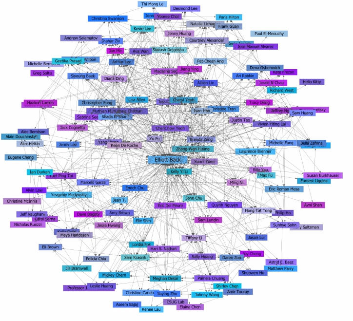
Statistical Map- These can represent distances relative to another property besides physical distance, and can thus be used to demonstrate relationships among entities. This is a statistical map of connectivity between people on the social media site Facebook. Individuals that appear to be close to others aren't necessarily close in a physical sense, or in any other way besides online (http://markvandykenewsroom.blogspot.com/2011/04/social-media-is-extremely-important.html).
Subscribe to:
Posts (Atom)